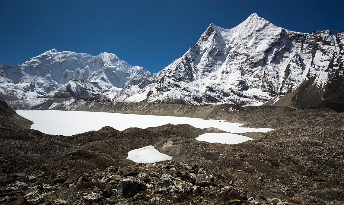
In the shadow of Mount Everest, at an altitude of 5,000 meters, lies the tranquil yet potentially perilous Imja Lake. This high-altitude glacial lake, formed by the melting of the surrounding ice, poses a significant risk to the villages downstream. The lake’s expansion, driven by climate change, could one day breach the morainic dam that holds it, unleashing a devastating flood. Monitoring this silent threat became the mission of a group of researchers from the International Centre for Integrated Mountain Development (ICIMOD), based in Kathmandu and network engineers from the Nepal Research and Education Network (NREN).
The project began with a vision: to harness the power of wireless networking technologies and wireless sensor networks to safeguard the communities living in the shadows of the Himalayas. Collaborating with network engineers from NREN and researchers from ICIMOD, based in Kathmandu, the project took shape amidst the challenging terrain and weather of the high Himalayas.
Enabling research
“Building the network was one thing,” reflects Gaurab Raj Upadhaya, founding Technical Director and Architect for Nepal’s research and education network. “We did a pretty good job on both the business model and the network itself, but one of the main things with an NREN is to actually enable primary research. We were fortunate to have a group of Japanese researchers interested in high-altitude climate change. They identified a critical project: monitoring the melting glaciers and the increasing water volume of Imja Lake.”
The project aimed to measure the rate at which the glacier was melting by tracking the lake’s surface area expansion. To achieve this, the team needed to deploy sensors at a high altitude of around 5,300 meters. These sensors would relay data back to the researchers, providing real-time insights into the glacier’s behaviour and the lake’s growth.
Working with the Japanese researchers, the team placed sensors around the lake. The real challenge was establishing a reliable communication link in such a remote location. Gaurab and his team set up two relay stations at approximately 5,400 meters, which connected back to the small town of Namche. From Namche, the data was beamed up via satellite to the rest of the world.
“This was one of the earliest projects we worked on with researchers,” Gaurab recounted. “We learned a lot from that experience. The sensor network collected invaluable data on the rate of rise of the lake, but we also discovered the challenges of operating technology at high altitudes. For instance, batteries don’t perform well in such extreme conditions.”
Providing crucial insights
Despite these challenges, the project was a success. The data collected provided crucial insights into the glacier’s melting patterns and the potential risk of flooding. It also showcased the feasibility of using wireless technology in one of the world’s most inhospitable environments.
The glacial lake, once an isolated and enigmatic feature of the Himalayan landscape, had become a well-monitored sentinel, thanks to the dedication and ingenuity of Gaurab and his team. Their work not only advanced scientific understanding of climate change impacts in high-altitude regions but also underscored the importance of technological innovation in safeguarding vulnerable communities.
Watch video
https://www.youtube.com/watch?v=f2vz5A39EPs&list=PLjVwd8FlHBAQ69bcjBNVr4Tj6-xxme0GH&index=1