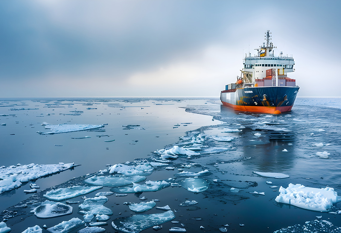
With rising temperatures and decreasing sea ice, the Arctic shipping season is steadily being extended, though conditions continue to be challenging. A research collaboration across the European Nordic countries develops a sea ice modelling tool that helps the shipping industry estimate risks. The tool also calculates the climate indicator for sea ice to predict future navigability in the Arctic Ocean.
Under the headline NOrdic CryOSphere Digital Twin (NOCOS DT), the project pools scientific resources from several countries to develop computational modelling.
“The tools developed by NOCOS DT will improve climate-smart practices and assessment of climate-related risks making shipping in the Arctic and Baltic Sea safer and more efficient,” according to the website of CSC, Finland’s national research and education network (NREN), a partner in the project.
Application for offshore wind power
A cornerstone of the project is the Helsinki Discrete Element Model (HiDEM) code. Originally developed for generic investigation of fragmentation processes and glacier calving, the code has been adapted to model sea ice breakup.
Sea ice breakup events produce drift and pack ice that have significant impact on shipping, offshore infrastructure, as well as fishing and hunting on sea ice. One of the major project objectives has been to construct discrete element model tools to act as complements to more traditional sea-ice dynamics forecast models. As a specific application HiDEM is currently used for investigating the interaction of sea ice with offshore wind power pylons.
The work with HiDEM is a collaboration between CSC – IT Center for Science, the Aalto University, and the Finnish Meteorological Institute.
Arctic transpolar route in focus
Over the past few decades, Arctic shipping has increased significantly. Occasions of ships navigating in extreme ice conditions have tripled. NOCOS DT has focused on the Arctic transpolar route aiming at developing statistics on seasonal risk variations.
The project has investigated the near-cast and now-cast Risk Index Outcome which can be used as a climate indicator for real-time navigation decision-making for ships in various ice conditions. The novelty lies in the ability of the tool to calculate the climate indicator from modeling sea ice data to gain insight on past and future navigability in the Arctic Ocean.
In the future, the historical sea ice regime and projection on future sea ice scenario by the Climate Change Adaptation Digital Twin model will be included to produce Risk Index Outcome climate statistics.
For landfast sea ice, the project builds on the Danish Meteorological Institute’s hindcast and forecast products. The project is deriving a tool for analyzing whether sea ice is landfast.
Sea ice cover affects seals
Following discussions with the Swedish Agency for Marine and Water Management and the Nordic-Baltic Marine Spatial Management Tool project (financed by the Nordic Council of Ministers), the project has been preparing aggregated information from high-resolution ocean and sea ice model projections. The focus was on ice information, which has been shown to have impacts on certain ecosystem components, such as seals.
The software packet is optimized to handle large, multi-ensemble data sets and to present ensemble mean and uncertainty information. It will be further developed to handle extreme information, e.g. about marine heat waves.
The NOCOS DT project started in February 2023 and will finish in January 2025. The project contributes to the Destination Earth’s Climate Change Adaptation Digital Twin. Destination Earth is a flagship initiative of the European Commission to develop a highly accurate digital model of the Earth.
The text is inspired by the article “Innovation digital twin tools for sea ice in the Arctic and Baltic contexts” at the CSC website.