Dr. Javier Sellanes, a professor at the Universidad Católica del Norte is manager of the project that gave life to Pandora, the platform that manages a distributed repository network for the conservation of information related to biodiversity in Chile, including over 30 thousand species of flora and fauna.
As weather forecasts are becoming increasingly detailed, data volumes are increasing as well, demanding high-speed connectivity and supercomputing power.
A lake of lava lies directly below a small South Korean island. The simulations that led to this discovery were performed on supercomputer Piz Daint at the Swiss National Supercomputing Center and the now decommissioned Huygens, the national supercomputing center of SURF in the Netherlands.
The Nordic research and education networks are preparing to put a whole new network infrastructure in place for EISCAT 3D, as the powerful new radar is situated in remote northern Scandinavia to assure a minimum of background noise. For the next 35 to 40 years to come, it will be the centerpiece of the international network of instruments monitoring the Earth’s upper atmosphere and space environment.
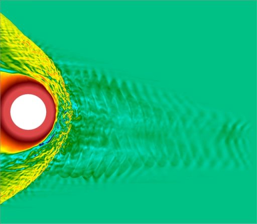
As computer simulations go, Vlasiator is as huge as they come. Developing Vlasiator, Minna Palmroth, professor at the Finnish Meteorological Institute, has succeeded in doing what many of her colleagues thought impossible: Simulating weather in near-Earth space, showing how solar wind affects us, using high performance computing and high speed networks to do so.
The Spanish Institute of Oceanography is one of the first organisations in the world to solely dedicate itself to researching the sea and its resources. Its broad and diversified activities require an accurate database capable of accommodating millions of data items, as well as a powerful connections to researchers and national and international centres with which it shares information.
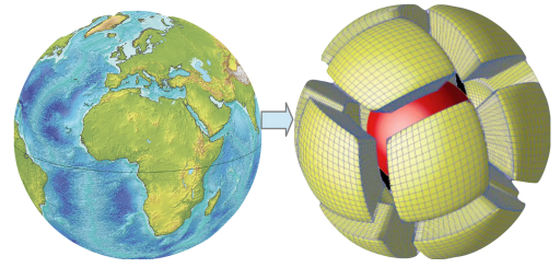
The Earth is a complex and dynamic system, and the inner workings of our planet have serious catastrophic potential for humans in the form of earthquakes and volcanic eruptions. Using e-infrastructure resources and supercomputers, a research group at the University of Oslo, Norway, is investigating the link between processes which occur deep in Earth’s interior, and those at the surface.
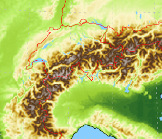
Moroccan and French researchers are using high-speed networks to combine their expertise in Geographic Information Systems (GIS) and remote sensing to produce new thematic maps of
Agadir, Morocco and to monitor this fragile landscape.