Have you ever stopped to think about how weather and climate research influence your daily life? “This science has a direct impact on the daily lives of us all, from small decisions, such as whether to bring a coat or an umbrella or not, to government analyses, such as whether there will be enough water in the reservoirs of the dams of the hydroelectric power plants to produce electricity.”
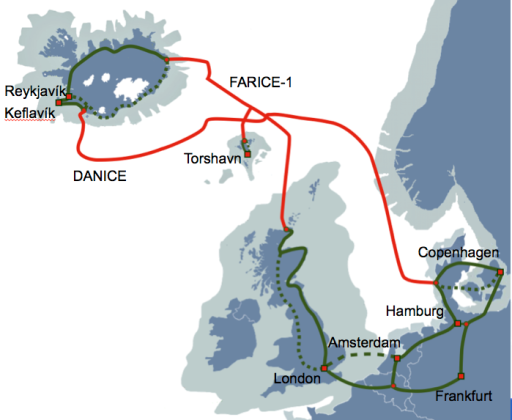
Three research networks are working together to provide the lifeline of a new meteorology supercomputer running on renewable energy. Through a 10 Gbps redundant fiberoptic cable running 2250 km across the North Atlantic, the Danish Meteorology Institute in Copenhagen connects to its new supercomputer located on Iceland.
Moroccan and French researchers are using high-speed networks to combine their expertise in Geographic Information Systems (GIS) and remote sensing to produce new thematic maps of
Agadir, Morocco and to monitor this fragile landscape.
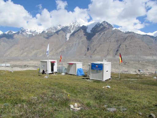
Understanding how the environment is altering through ongoing monitoring is key to coping with the effects of climate change. Working with European partners, the Central Asian Institute of Applied Geosciences (CAIAG) in Kyrgyzstan is able to monitor melting glaciers and mitigate the risks to the local population.
Ross Vennell is a man driven by a challenge. He is a physical oceanographer investigating how we could generate electricity from tidal currents, “a bit like having wind turbines under the water”. New Zealand is one of the best places on the planet to extract energy from the ocean, and Ross is trying to estimate how much power we could actually get from turbines.
With extreme weather events increasingly hitting news headlines around the world, accurate and timely forecasts are essential for effective disaster warning and mitigation systems. This, in turn, calls for joint research efforts within the global meteorological community to improve models and tools for predicting severe weather, such as hurricanes, tornadoes, cyclones, floods, heat waves etc.
When the Latin American Observatory of Extraordinary Events announced in October 2011 that rainfall was expected to be above average for the South American Northwest and above average for the Southeast of the same region, an early alert for floods was issued for Panama, Colombia and Venezuela, and one of a drought for North-western Argentina, Uruguay and Paraguay. This is an example of how the information gathered and disseminated by the Observatory, a collaboration involving a number of institutions, helps Latin American nations with risk management for extreme environmental events.
More than 20 countries are present in Ny-Ålesund in the Arctic, operating their own research facilities. The most northerly fibre optic cable system in the world has been installed to ensure that the massive amounts of data produced there can be transferred ”live” to global research networks.
Ocean Networks Canada (an initiative of the University of Victoria) is developing a software system to co-ordinate readings from underwater sensors in order to detect and report natural hazards, such as earthquakes and tsunamis. This system has the potential to help save lives and limit the impacts of natural disasters.


